Project 1:Atlantic & Burlington County Sites
Priority
49 - Pork Island
Pork Island is a
partially confined site with low, incomplete berm walls located immediately
adjacent to the access road to Margate City, NJ. Situated along Beach Thorofare (also the NJ
Intracoastal Waterway), this site was a one-time use in 1938 when the NJ
Bureau of Commerce and Navigation contracted to have the channel in Beach
Thorofare straightened south of the Margate access road toll bridge. This was done in two stages creating the
Pork Island site in 1938, followed by an unconfined discharge onto the
marshes south of Pork Island as further efforts were expended to continue a
straight channel south several thousand feet.
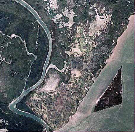
The second effort took place prior to February 26,1940 aerial
photographs, which show an extensive sheet of white sand covering the sites
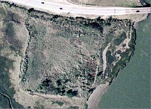
called Pork Island South and Dune Island sites 1-4. Pork Island (north)
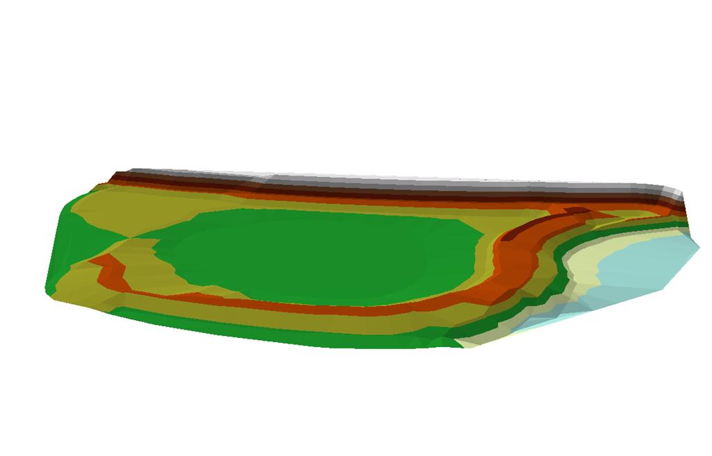
occupies 181,656 square feet (4.176 acres) and has a partially filled
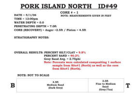
interior. A single core was taken that
penetrated 7.0 feet of relatively clean sand (90.2% sand in the composite). The core was taken along the eastern
interior area on the higher elevations present at the site. Penetration to the original salt marsh was
achieved at 7.1 feet in the core. The
site is presently designated the “Pork Island Wildlife Refuge” and as such
probably makes perpetual use development unlikely. In addition, the Margate Causeway is
privately owned and there are three smaller bridges between the Pork Island
site and the mainland that presently will not support heavy tri-axel trucks
needed to remove the sand.
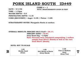
The Pork Island
South site is a complex of irregular areas of plant growth on the topographic
high points of the 1940 sediment discharge from dredging Beach Thorofare. Sampling found that these
higher areas were fine white sand with a thickness of less than 5 feet over
the original marsh. The plant cover
was mostly Phragmities and Iva frutescens (Salt
Marsh Bush Elder) plus a few scattered red cedars. There was no attempt to confine the spread
of dredge material discharged onto the marshes in 1940, so the area has
developed into a complex array of islands and marsh areas actively supporting
a large variety of shorebirds. Nesting
gull species, snowy egrets, black back skimmers were among the most commonly
seen. This is a legacy site with
extensive habitat available for the birds, terrapin turtles and other small
mammals, so that these areas should remain undisturbed. The four Dune Island sites immediately
south of the larger Pork Island South complex represent the southernmost area
of this side-cast channel straightening project deposit. Now small islands of clean sand they form a
complex of bird nesting habitat and prime locations for diamondback terrapin
nesting. |
|
|
|
|