Project 1:Atlantic & Burlington County Sites
Priority
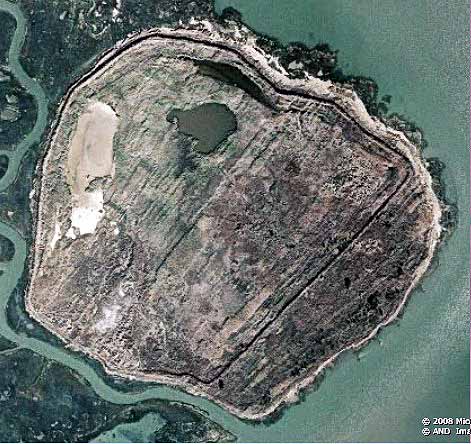
72 - Black Point
Black Point is
the largest site in Atlantic County and is
located beside the NJ Intracoastal Waterway south of Great Bay adjoining the
Forsythe National Wildlife Refuge impoundments for bird nesting. This is a confined site with substantial
berm walls enclosing 2,571,527 square feet (59
acres). The site has not been used in over a decade
as evidenced by the density of vegetation in the interior. There were multiple species of freshwater
trees, abundant poison ivy plus the usual Phragmities stands. On the northwest side are three freshwater
ponds as habitat for multiple species of ducks and other shorebirds. Evidence also was found for resident
populations of deer, fox, raccoons, possum and other small mammals. The southwest corner contained the highest
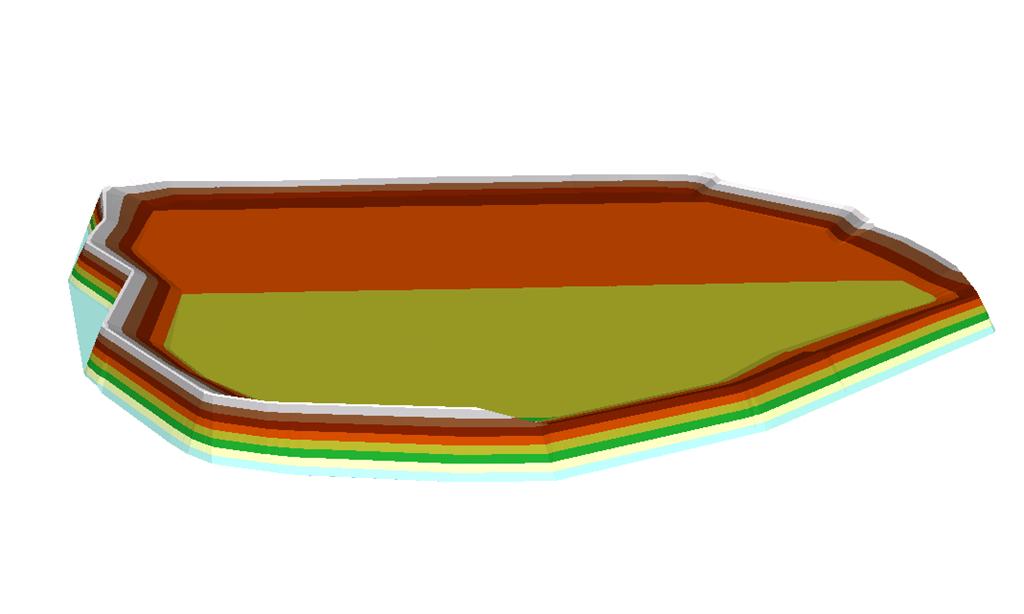
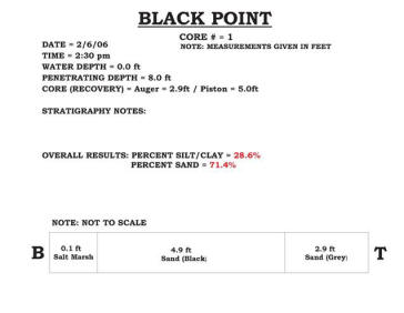
elevation in the interior Sediment sampling consisted of three cores positioned within the interior in diverse locations that showed the following:
No core reached the underlying salt marsh, but the elevation (~ 8 ft.) of the interior surface would indicate that the core reached at least to the elevation of the original salt marsh that once existed at this site. This site is owned by the Forsythe National Wildlife Refuge, so reuse is probably limited by the presence of two other CDF sites along this section of the IWW and the communication from the wildlife refuge manager that the US Army once used the site as a bombing target during WW II, so the potential for parts of or unexploded ordinance is a possibility. |
|
|
|
|
|
|
|