Project 1:Atlantic & Burlington County Sites
Priority
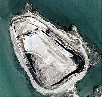
73 - Shad Island
Shad Island is
the second largest of the three sites along the northern channel of the NJ
Intracoastal Waterway into the Great Bay in Atlantic County. This is the current disposal site for
southern Great Bay and the NJIWW. The
berm walls rise about 20 feet above the surrounding marshes and the site is
divided into one small and one large cell with a drainage gap connecting
them. The site covers 1,260,005 square
feet, (28.9
acres) and is partly vegetated with Phragmities along the outer and inner perimeter
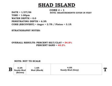
wall slopes, with a largely open interior floor due to recent use. There were three cores obtained that
covered the longest axis of the site.
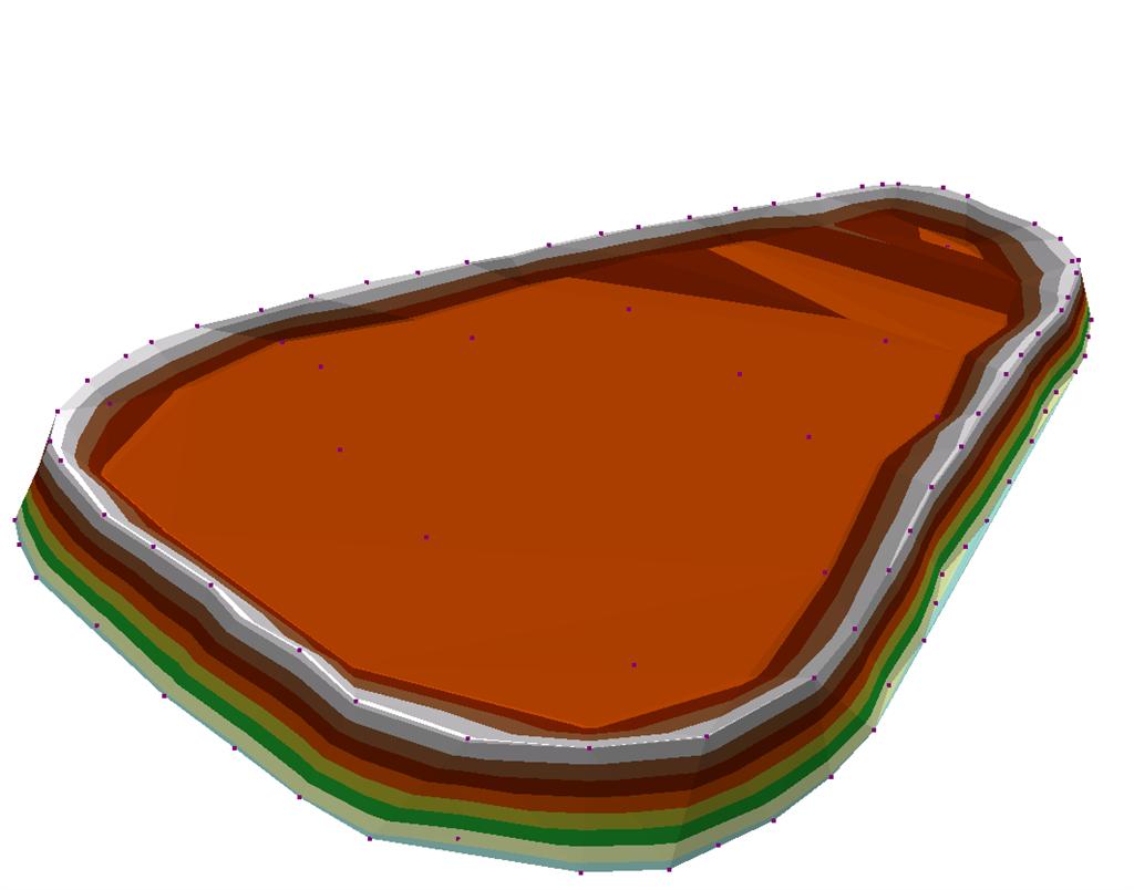
The sediment volume
is approximately 798,000 cubic yards and could
be accessed from the waterway if modifications to create a landing zone at
the northwest corner of the site were completed to make a dock area so barges
could be brought up to the berm and equipment off-loaded and sediment transferred
to the barges for processing elsewhere or on site if proven economical to do
so. |
|
|
|
|
|
|
|