Project 1:Atlantic & Burlington County Sites
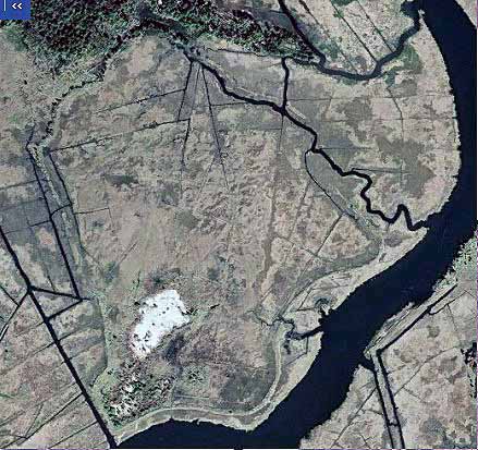
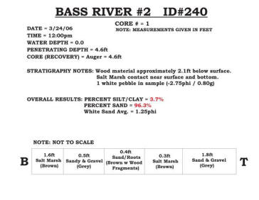
240 - Bass River #2
Five of the seven sites along the Bass River plus the two Collins Cove sites appear to be associated with roadbed construction for the Garden State Parkway back in the 1950’s because the highway rests on a bed of fill over 2 miles in length leading to the fixed bridge crossing the Mullica River. Bass River #2 is an enclosed area of salt marsh close to the uplands boundary to the north, which contains just one large area of coarse material that does not support extensive vegetation. The central barren region of the deposit rises over 15 feet above the salt marsh elevation. The remainder of the interior of the berm area is a mix of Phragmities and marsh plants fed by tidal flow through breaches in the low berm wall. This site lies adjacent to the Bass River. |
|
|
|
|
|
|
|