Project 1:Atlantic & Burlington County Sites
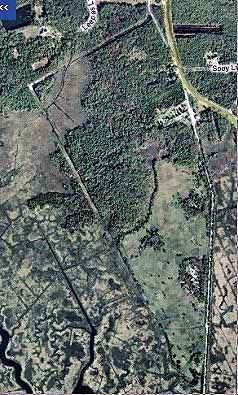
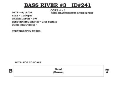
241 - Bass River #3
Five of the seven sites along the Bass River plus the two Collins Cove sites appear to be associated with roadbed construction for the Garden State Parkway back in the 1950’s because the highway rests on a bed of fill over 2 miles in length leading to the fixed bridge crossing the Mullica River. This site lies west of the Garden State Parkway and merges with the uplands at its northern end. A berm follows and outline of the vegetation and turns north along the west margin at a power line. The coarse sandy gravel material is more widespread and varies in elevation from not much higher than the surrounding salt marsh to about 7 feet higher. The majority of the dredge material lies along the eastern margin with the former roadbed of US Route 9 that once carried traffic across the Mullica River Estuary. Over half this site is normal salt marsh in the interior as well. |
|
|
|
|
|
|
|