Project 1:
Priority Confined Disposal Facility – CDF
89 - Tuckerton Creek CDF #1
Tuckerton Creek #1 CDF occupies 8.8 acres within the salt marsh and is accessible by both land and water. The CDF is within 500 ft. of Barnegat Bay Blvd. and the eastern berm wall borders Barnegat Bay. Tuckerton Creek #1 appears to have been repetitively utilized for a dredge material placement site. The CDF has well defined berm walls (approximately 7.5 to 8.5 ft. NAVD88 crest elevation) that are lightly covered with Phragmites and brush. A water discharge weir-box that appears to have not been used in several years is located on the southwestern corner. Adjacent to the weir box is a 200ft by 90 ft pool of water approximately 3.5 ft deep. A triangulated irregular network (TIN) was made for the entire CDF using collected GPS data. It is estimated that the CDF contains 36,167.75 yds3 of dredge material. Three cores were obtained within this site and document a very fine sand with a 15% mud fraction and extensive penetration by marsh plant roots over the entire length of the core. |
|
|
|
|
|
|
|
|
|
|
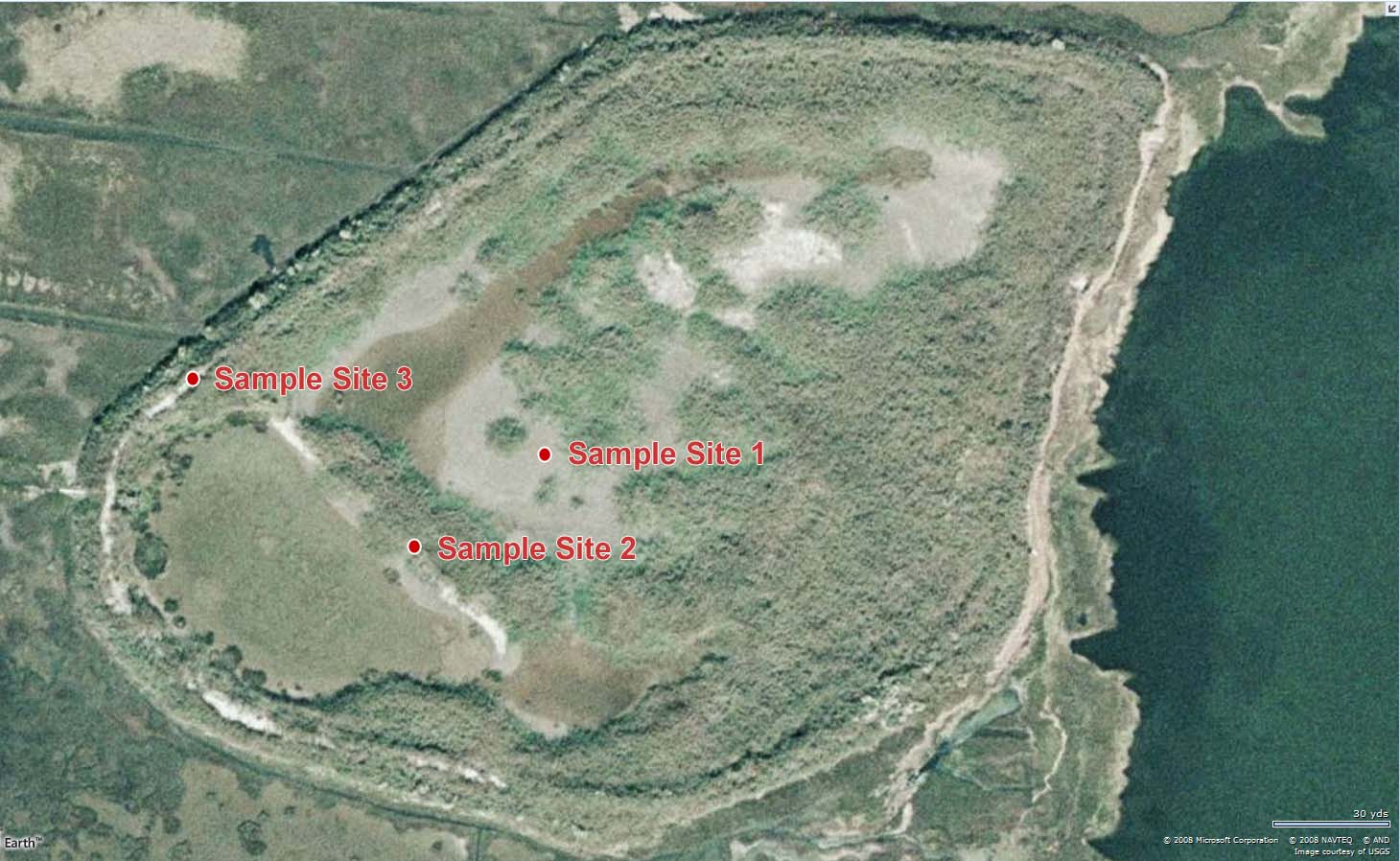
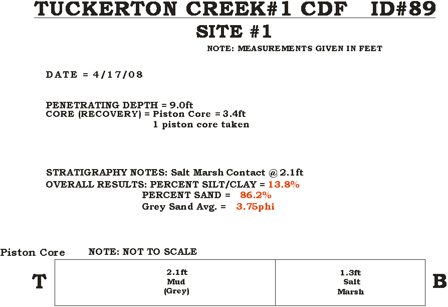
The first core encountered the original
salt marsh surface at 2.1 feet of depth in very fine muddy sand placed within
the confines of the CDF. The other two
samples came from soil auger cores of the site at other locations.
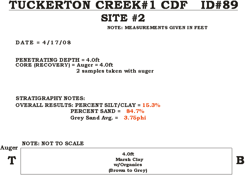
The second site auger core penetrated 4.0
feet into the original salt marsh surface yielding samples that were also very
fine sand and mud with organics resulting from plant root growth.
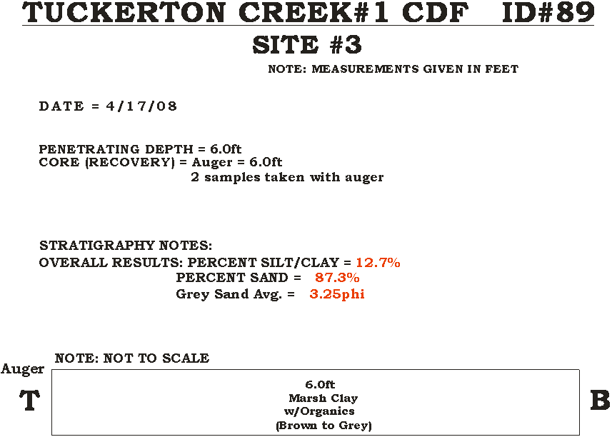
The third auger core site encountered organic rich very fine sand and silt mixed over a depth of penetration of 6.0 feet. This site’s size and relatively limited dredge material quantity means that much of the interior is composed of the original salt marsh surface without burial by the dredge sediments.