|
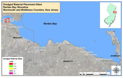
Raritan Bay Site Characterizations: Click site links below for a brief description and supplemental data associated with each site (i.e. sediment data, photographs). To view where these sites are located along the Raritan Bay shoreline, view the Site Map below.
Follow this hyperlink to view the full state version in Google Earth: NJ Dredged Material Sites (To view these files, you will need to have Google Earth installed on your computer.)
**The sites highlighted in red are the chosen candidate sites which have attributes that favor the possibility of beneficial use** The following Raritan Bay sites
are listed by their respective CRC given I.D. numbers found in the site
delineation shapefile:
|
|
|
|
|
|
|
|