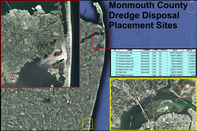
Project 1:Monmouth A total of eight sites were
identified for The
Site Map below
shows the locations of CDFs, CDSs, and UDSs identified for
Follow this hyperlink to view the Monmouth County version in Google Earth: Monmouth County Dredged Material Sites Follow this hyperlink to view the full state version in Google Earth: NJ Dredged Material Sites (To view these files, you will need to have Google Earth installed on your computer.)
**The sites highlighted in red are the chosen priority sites which have attributes that favor the possibility of reuse** The following CDF CDS
UDS
|
|
|
|
|
|
|
|