Delaware River & Bay Site Characterizations:
Click site links below for a brief description and supplemental data associated with each site (i.e. sediment data, photographs).
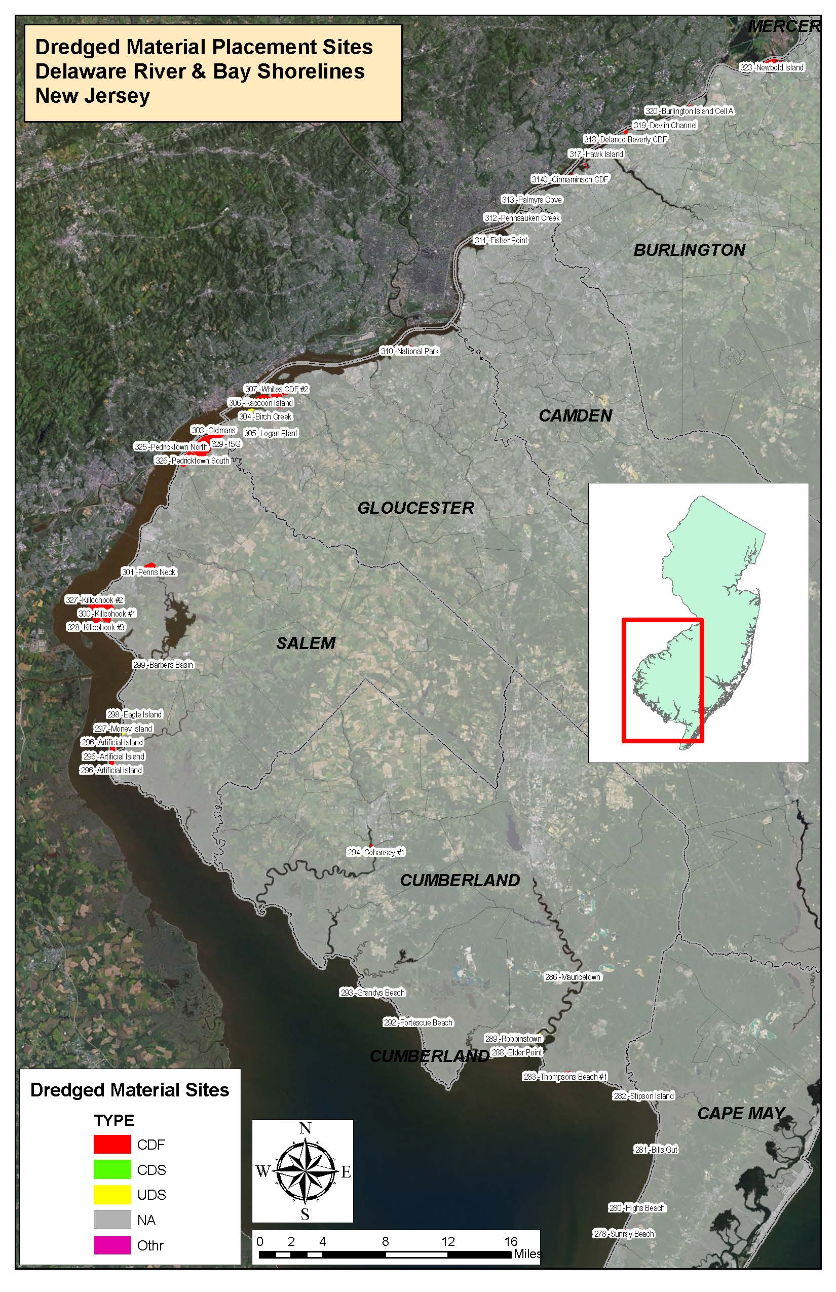
To view where these sites are located along the waterways of the Delaware River & Bay, view the Site Map below.
Follow this hyperlink to view the full state version in Google Earth: NJ Dredged Material Sites
(To view these files, you will need to have Google Earth installed on your computer.)
![]()
**The sites highlighted in red are the chosen candidate sites which have attributes that favor the possibility of reuse**
The following Delaware River & Bay sites are listed by their respective CRC given I.D. numbers found in the site delineation shapefile:
- 026 - Dredge Harbor
- 279 - Paramount Air
- 280 - High's Beach
- 281 - Bill's Gut
- 282 - Stipson Island
- 283 -Thompson's Beach #1
- 284 - Thompson's Beach #2
- 285 - Matt's Landing
- 286 - Mauricetown
- 287 - Warren
- 288 - Elder Point
- 289 - Robbinstown
- 290 - Wave Creek
- 291 - Indian Creek
- 292 - Fortescue Beach
- 293 - Grandys Beach
- 294 - Cohansey #1
- 295 - Cohansey #2
- 296 - Artificial Island
- 297 - Money Island
- 298 - Eagle Island
- 299 - Barbers Basin
- 300 - Killcohook #1
- 301 - Penns Neck
- 303 - Oldmans
- 304 - Birch Creek
- 305 - Logan Plant
- 306 - Raccoon Island
- 307 - Old Canal #1
- 308 - Old Canal #2
- 310 - National Park
- 311 - Fisher Point
- 312 - Pennsauken Creek
- 313 - Eightmile Point
- 314 - Riverton Cove
- 315 - Wright Point
- 316 - Castle Harbor
- 317 - Hawk Island
- 318 - Enterprise Range
- 319 - Devlin Channel
- 320 - Burlington Island A
- 321 - Burlington Island B
- 323 - Newbold Island
- 325 - Pedricktown North
- 326 - Pedricktown South
- 327 - Killcohook #2
- 328 - Killcohook #3